New Zealand’s 11 Great Walks, ranked
Which Great Walk is the greatest? Here’s my completely unscientific opinion
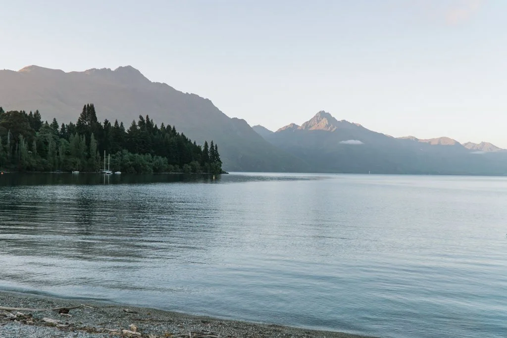
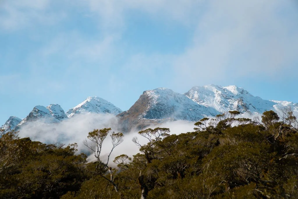
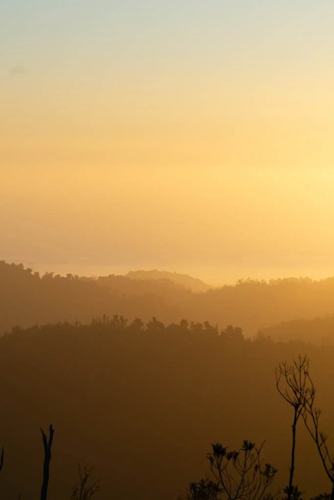
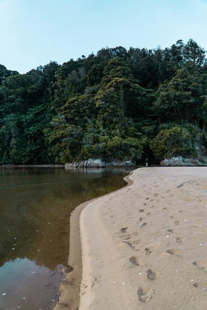
On the Paparoa Track, you can see the Tasman Sea from high up in the mountains
Hiking is in New Zealand’s blood. With an abundance of beautiful wilderness criss-crossed with hiking trails and riddled with backcountry huts, going on multi-day backpacking (or tramping, to use local lingo) trips is a national past time.
I hike almost by default — how else to explore this vast and wonderful country I call home?
Over the past few years, I’ve hiked 9 out of 11 of New Zealand’s Great Walks, so I can tell you for certain; the Great Walks are some of the best hiking trails in the country.

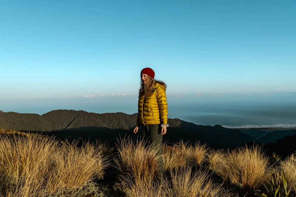
Different hike as above, same jacket and hat — this is on the Tongariro Northern Circuit during winter
Great Walks traverse national parks like Fiordland, Mount Aspiring, and Tongariro, with well-formed tracks, comfortable huts, and even luxuries like solar lighting. On the Paparoa Track, you can hook your phone up to a USB charging port, almost unheard of in standard backcountry huts.
The Great Walks are designed to be accessible — you don’t need to be a hardened backcountry expert to take them on.

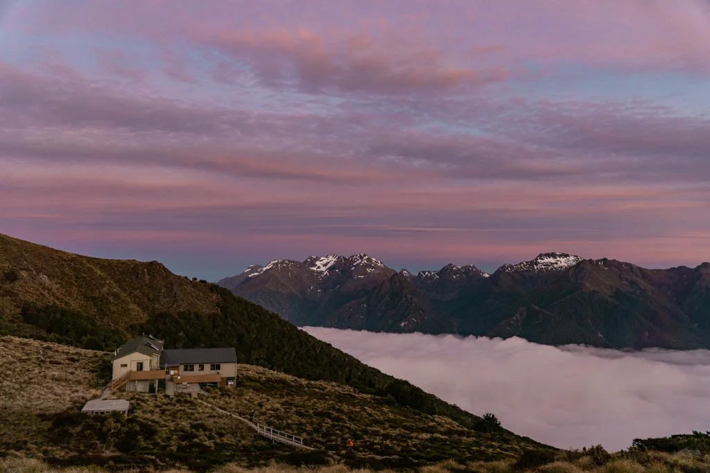
Moonlight Tops Hut, on the Paparoa Track
I have yet to hike Milford Sound — I had hut bookings for March 2020, and even if the pandemic hadn’t struck, that year the track closed due to storm damage. It wasn’t meant to be.
The Rakiura Track also keeps eluding me, but I’ll make it to Stewart Island soon.
All the Great Walks have unique features. One isn’t even a walk, it’s a canoe trip down a river. So which Great Walk is the best?
If you’re wondering which one to add to your New Zealand itinerary, this is my take on (almost) all of the tracks.
The short version: A quick overview of New Zealand’s Great Walks
Routeburn Track: Best all round Great Walk, and one of the easiest to experience on a day hike. If you choose one Great Walk, I would make it this one.
Milford Track: Legendary in status, the hardest one to get bookings for
Paparoa Track: A purpose-built track that exceeded all my expectations
Abel Tasman Coast Track: Stunning beaches and unique as a kayak/hike combination adventure
Kepler Track: Spectacular ridge walking through the heart of Fiordland
Tongariro Northern Circuit: Incredible volcanic landscapes
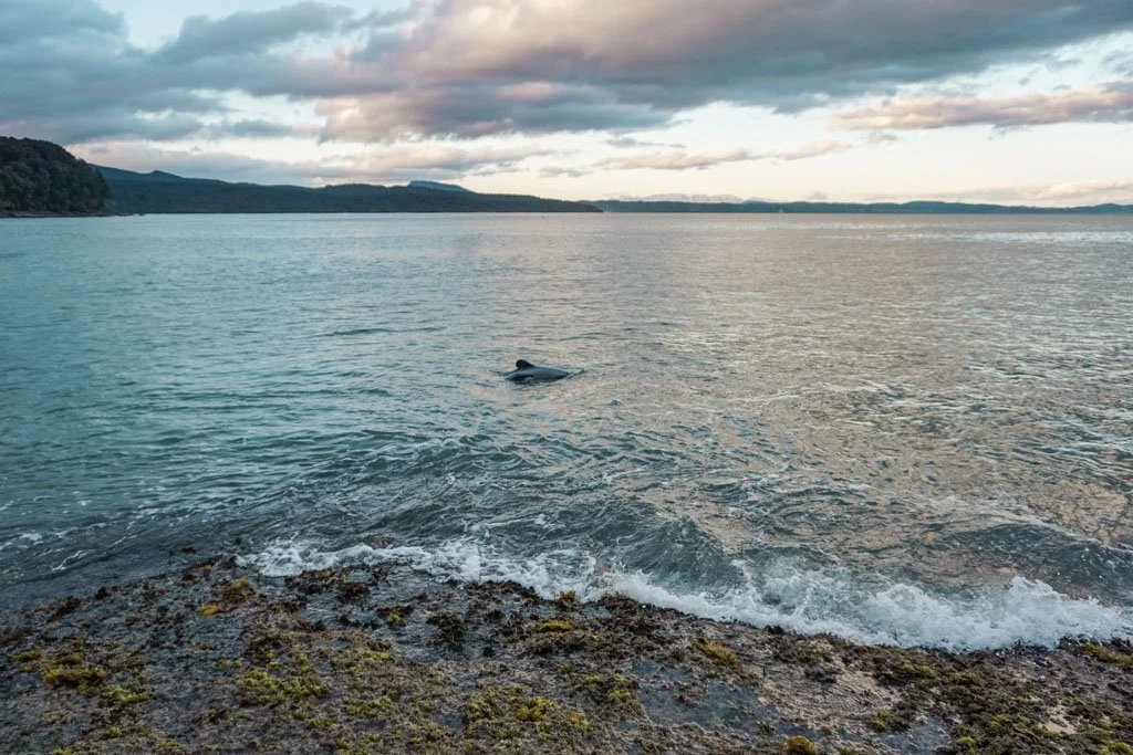
Hump Ridge Track: Some of the best wildlife I have seen on a Great Walk (swimming with Hector’s dolphins, and Fiordland crested penguins)
Heaphy Track: An epic journey (the longest Great Walk) accessible all year round
Lake Waikaremoana: A more rugged, backcountry walk
Rakiura Track: On my to-do list; I have heard mixed reviews of this one
Whanganui River Journey: Probably wouldn’t do this again, proof I am more of a hiker than a canoe paddler
And a quick note on choosing hikes
I’m being a little tongue in cheek by saying I’m ranking the Great Walks — they are all wonderful experiences in themselves.
And that goes for so many hikes in New Zealand. There are many epic multi-day hikes which aren’t on the Great Walks list; all of the hikes in Aoraki/Mount Cook National Park, for one thing.
So, if you’re struggling to get hut bookings for the Great Walks, or not sure you can fit a 3-4 day hike into your itinerary, I’ve tried to include other options you can look at.
The Routeburn track; short, sweet, and easily the best Great Walk

Key Summit, a stunning viewpoint on the Fiordland end of the Routeburn track — this is a great little day hike if you don’t want to do the full Routeburn
The Routeburn Track is the shortest Great Walk — it’s only 32 kilometres (20 miles) and takes 2-4 days, although some people even trail run it in one day.
The Routeburn stands above the rest of the Great Walks because it links Fiordland National Park and Mount Aspiring National Park.
You get to see not one, but two spectacular wilderness areas.
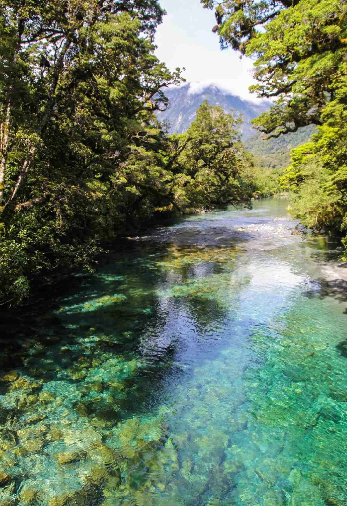
With alpine lakes, azure blue rivers, and spectacular views from along the trail, the Routeburn is one of the most scenic hikes in the South Island.
Hiking the Routeburn is a logistical challenge, as you set off near Glenorchy and end up on the Milford Sound road, an hour’s drive from Te Anau.
You can organise shuttles fairly easily from Queenstown, but I solved the one-way problem by hiking in, camping at Lake Mackenzie, and hiking back out the next day.
Getting there
Leave from Queenstown, finish in Te Anau
Do it as a day hike
If you’re lucky with the weather and only have a day at your disposal, you can hike in as far as Harris Saddle on a day walk. This is a pretty spectacular highlight reel of the Routeburn’s scenery, but it’s a long day.
You can also hike up to Key Summit from the Fiordland/Te Anau end of the Routeburn, which is an awesome half-day walk into lush mountain scenery.
Best alternative if the Routeburn is booked up
The Greenstone Caples track is beautiful and very quiet compared to the Routeburn.
It doesn’t have the same awe factor as the Routeburn, but it’s an awesome way to see more of the same area.
The Milford Track, the most famous Great Walk but equally, the hardest to book
The Milford Track — photo credit Liz Carlson
The most famous Great Walk in New Zealand is the Milford Track in Fiordland National Park in the South Island.
The trail has been drawing in visitors since the 1800s, and has something of a mythical quality.
Despite the torrential rain the area is known for, this is the track people compete for most vigorously; getting bookings is almost certainly harder than the hike itself.
This four-day trek runs through Fiordland National Park, leading hikers over high mountain passes and dense forest. The trail ends at Milford Sound, where you have the option of rounding out the trip with a scenic boat cruise.
I’m putting the Milford Track second, as a reflection of how much I — and many others — want to walk it.

The water taxi to the Milford Track — photo credit Fiordland Outdoors
Getting there
You could set off for the Milford Track from either Queenstown or Te Anau
Do it as a day walk
A brilliant option — that I have yet to try, but which is high on my list — is to go on a day walk on the Milford Track. You’re essentially just paying for a short water taxi back and forth to the track, but it’s a neat way to experience a bit of this famous walk.
You can also do a day walk on the Milford Track from the Te Anau end — again, this is a scheduled water taxi across the lake to give you the chance to get a little taste of the Milford Track.
Best alternative if the Milford Track is booked up
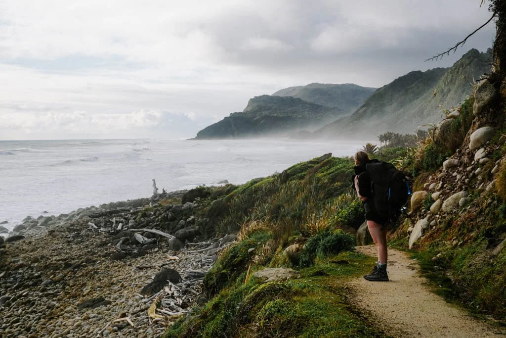
I recently went on a little overnight walk on the Hollyford Track, which is also in Fiordland National Park. It blew me away with its beauty.
You won’t have Great Walk amenities on the Hollyford, but the scenery is still spectacular.
I would highly recommend even a quick overnight jaunt to the Hidden Falls hut.
TREAT YOURSELF AFTER
Milford Sound Lodge
The Milford Track finishes up in Milford itself, so you could spend a night in the lodge to relax after the hike, and maybe go on a boat cruise while you’re there.
The Paparoa Track, where you can stand in the mountains and see the sea

The Paparoa Track is a purpose built hiking and cycling trail in Paparoa National Park, covering 55 kilometres in three days.
Prior to the Great Walk opening, the Paparoas was almost inaccessible, unless you were willing to bash your way through some pretty thick bush along overgrown tracks.
I chose to hike the Paparoa track because it’s one of the few Great Walks you can do in winter in the South Island (other alpine treks, like the Routeburn, Milford, and Kepler, are too dangerous in winter conditions).
It blew me away.
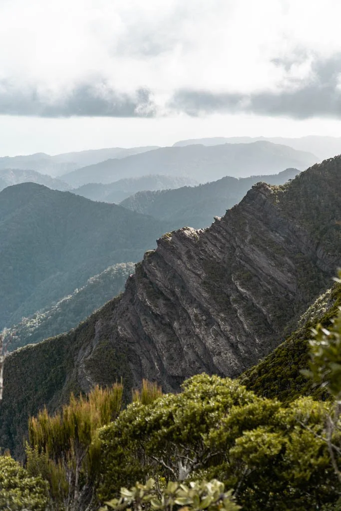
Limestone mountains falling away into the distance
Sunset views out to sea, from the second hut on the track
A highlight of this track is staying in the Moonlight Tops Hut up on the Paparoa Range.
From Moonlight tops, the trail follows an impressive limestone escarpment, with points on the trail where you’re standing on the edge of a cliff.
One of the things I loved most about this trail was how you could keep the Moonlight Tops hut in sight for almost the entire second day — 19 or so kilometres of tracing ridgelines in a horseshoe.
Do it as a day walk
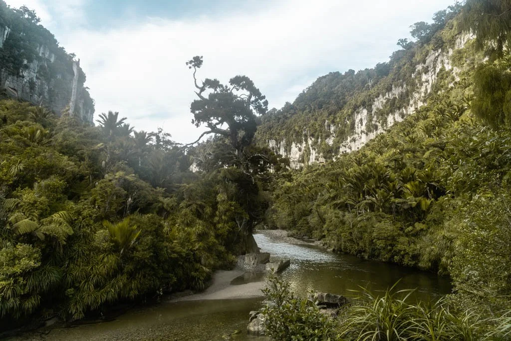
The final section of the track explores the Porari River Gorge, a beautiful limestone gorge with a clear river running through dense groves of nikau.
You can walk this section as a a day walk from Punakaiki. I highly recommend if you get the chance.
It’s one of my favourite short walks on the West Coast and takes around 2 hours return.

TREAT YOURSELF AFTER
Pahautane Ridge
Punakaiki makes an excellent place to finish a long hike, thanks to the beautiful accommodation along the West Coast. I loved the outdoor bath at Pahautane Ridge, a little studio overlooking the ocean.
The Abel Tasman Coast Track, a hiking and kayaking adventure to some of New Zealand’s best beaches
Hiking and kayaking the Abel Tasman is one of New Zealand’s coolest adventures
The Abel Tasman Coast Track takes in some of the best coastal scenery in New Zealand.
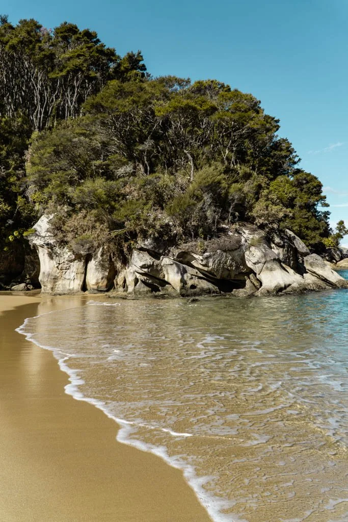
Abel Tasman National Park is a string of golden beaches with turquoise water, bordered by lush native bush. The track runs from beach to bay, offering up endless glittering ocean views.

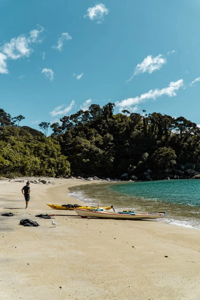
As well as walking the Abel Tasman Track, you have the option of kayaking sections — a great way to get up close to seals and pulling into beaches that aren’t accessible on foot.
I completed a three-day kayaking and hiking trip (two days kayaking, one hiking) with Abel Tasman Kayaks, and it was great.
I’m no kayaker, but it was a fun way to see more of the national park.
Another thing I love about Abel Tasman is that the coastal track means campsites (or huts — but I have always camped the Abel Tasman) are right next to the water.
Being able to strip off your pack and jump straight into pristine water is one of the highlights of this track.
Do it as a day walk
The Abel Tasman is one of the best Great Walks for a day trip.
You can get a water taxi into the park and hike out (or vice versa), or kayak one way and hike or water taxi the other.
Abel Tasman Kayaks (the same company I rented with) offer a kayak and walk option.
What to do if Abel Tasman is booked out
The Queen Charlotte Track in Marlborough Sounds is another excellent coastal walk, and in some respects is even better than the Abel Tasman.
There are fewer golden beaches, but on the Queen Charlotte you can stay in actual lodges (with hot showers and restaurants) and get your pack ferried on to your next night’s accommodation, so you only walk with a day pack
The Kepler Track, an epic ridgeline walk through the heart of Fiordland
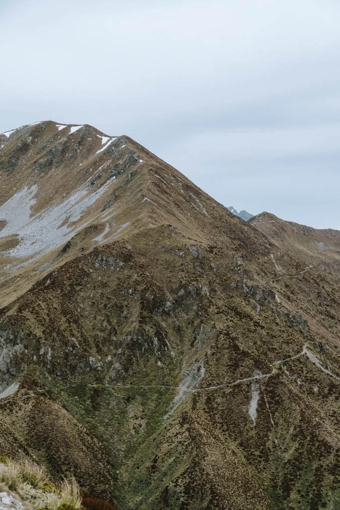
The trail of the Kepler weaves around the edge of mountains
3–4 days
60 kilometres
The Kepler Track, in Fiordland National Park, has lakes, beech forest, and alpine tops, adding up to one of the finest multi-day hikes in New Zealand.
Luxumore Hut in particular offers incredible views of the area, and the ridgeline beyond Luxmore is possibly the longest and most impressive ridge I have walked in New Zealand.
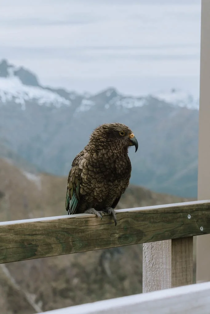
Kea are common on the Kepler

Look to the ground and you can see sun dews, little carnivorous plants
I’ve hiked the Kepler twice and both times I have been relatively lucky with the weather — the views from along that ridge are fantastic on a clear day.
My personal highlight of the Kepler, though, was seeing a kiwi in the wild for the first time near Iris Burn hut. You can hear them calling to each other in the evening, when all the humans have gone to bed.
Do it as a day hike
You can catch a ferry from Te Anau across to Brod Bay, and from there hike up to Luxmore hut and back.
Or if budget isn’t a barrier, you can catch a helicopter to the top and walk back down.
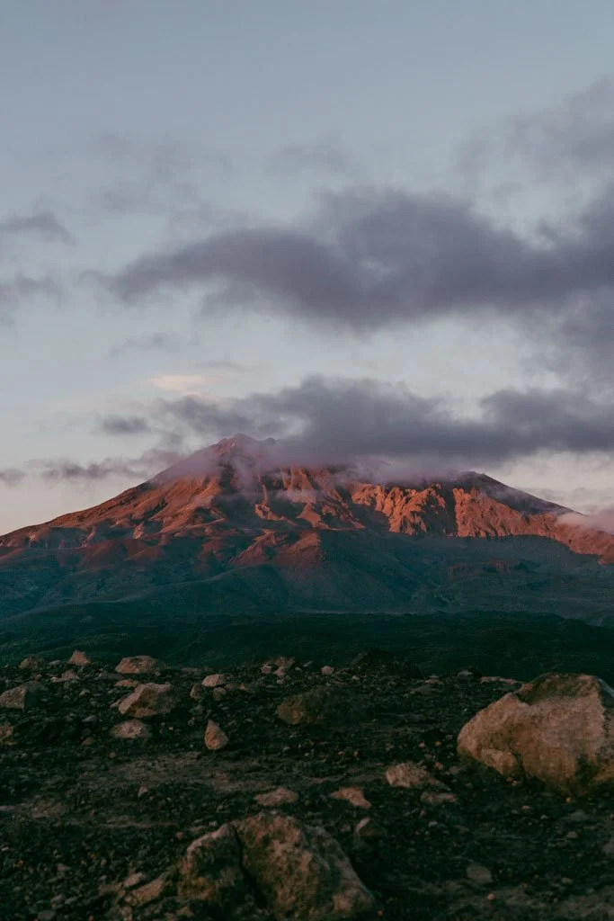
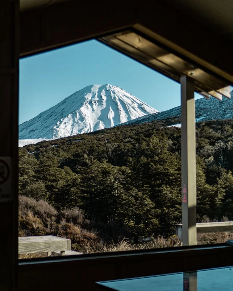
The Tongariro Northern Circuit
Waihohonu Hut on the Tongariro Circuit is a real highlight
Waihohonu has beautiful big windows for admiring the landscape
The Tongariro Northern Circuit is 43 kilometres, or a 3-4 day hike through the otherworldly landscapes in the centre of North Island.
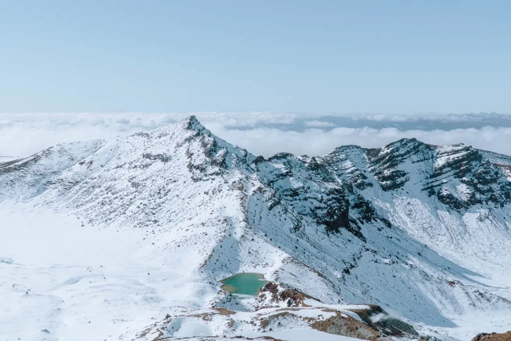
The main highlight of the Tongariro Circuit is the Tongariro Crossing, where the track climbs to the stark Red Crater for views of the Emerald Lakes below.
This part of the walk is very popular as a day hike, but as soon as you turn off the part of the track that the day trippers use, you’ll be almost on your own.
The landscape on this walk is incredible, with the volcanic cones on the skyline and an often barren, rocky expanse around where you’re walking. It feels a little like a lunar landscape.
The Tongariro Crossing in winter
I have walked sections of the Tongariro Northern Circuit — including the Tongariro Crossing — in winter. You need extra equipment to do this, and ideally plenty of experience, but if you’re up for it, that was one of the most unique views I’ve seen on a North Island hike.
Do it as a day walk
You can walk the Tongariro Crossing to cover the main highlights of this Great Walk. It’s a solid tramp, but you’ll see the Emerald Lakes and other worldly landscapes of the national park.
It’s a one way hike, so you’ll need transport at either the beginning or the start of the Tongariro Crossing — I opted to leave my car at the end and get a shuttle to the start of the hike, so I didn’t need to rush to meet a bus at the finish line.
The Hump Ridge Track, New Zealand’s newest Great Walk
The distinctive rounded fin of a Hector’s dolphin, in a bay near a hut on the Hump Ridge
The Hump Ridge Track covers epic terrain in Fiordland National Park.
There’s a grunty climb up to a height of more than 1000 metres, where you have amazing views of the bottom of the South Island.
The track then descends to the coast and follows an undulating and often boggy path along the water’s edge.
My highlights of walking the Hump Ridge track were seeing Hector’s dolphins by the Port Craig Lodge, and seeing a little Fiordland Crested Penguin somewhere along that south coast track.
There was also a hot shower (spectacular) and beds with pillows (a treat), not to mention hot porridge provided in the mornings.
These creature comforts make the Hump Ridge even more accessible than the other Great Walks.
The Heaphy Track, the underrated track that takes you to remote coastal areas
The Heaphy Track is the longest of the Great Walks — 78 kilometres one way, which takes 4-6 days — and it doesn’t have one single highlight that sells it as a walk.
But, if you’re up for a longer walk, I think the Heaphy is a seriously underrated sleeper hit of a hike.
The tracks starts (or ends) on the West Coast of the South Island, with the track running past deserted white sand beaches fringed with nikau palms.
Tracing a path through Kahurangi National Park, you end up in Golden Bay, a gorgeous area only a couple of hours from Nelson.
If you have time, lingering a day or two in Golden Bay is well worthwhile.
The Heaphy Track might be the best one to walk in winter. It’s open all year round and it’s nice and quiet in the colder months, but still not as cold as further south.
I liked the variation in terrain on the Heaphy Track, from the tropical-feeling coastline on the West Coast to the rich beech forest on the Golden Bay end of the trail.
The Heaphy Track has been designed as both a mountain bike track and a hiking track.
While this means you might occasionally have to jump aside to let cyclists hoon past, the good news is the track is an easy gradient the whole way.
The Rakiura Track
The Rakiura Track is a loop walk on Stewart Island/Rakiura.
This hike is one of the easier Great Walks, with no major climbs and only 32 kilometres to cover in three days.
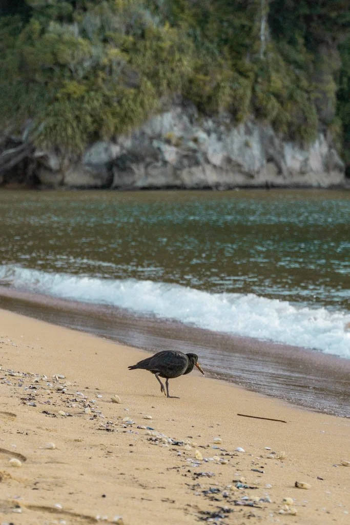
The Rakiura Hike is famously muddy, but also has a lot of native bush and bird spotting opportunities, as well as pristine beaches.
Lake Waikaremoana
Walk along the shores of the stunning Lake Waikaremoana, in a little-visited area of New Zealand.
The Lake Waikaremoana track is in the Te Ureweras rainforest, a wild and beautiful part of the North Island. Some of my most vivid memories of Waikaremoana are from the drive to the start of the track, where we passed through tiny communities where horses roamed wild when kids weren’t riding them to school.
This forest has a strong significance to the local iwi (Maori tribe) who live there, and it was granted personhood (along with the Whanganui River and Mount Taranaki).
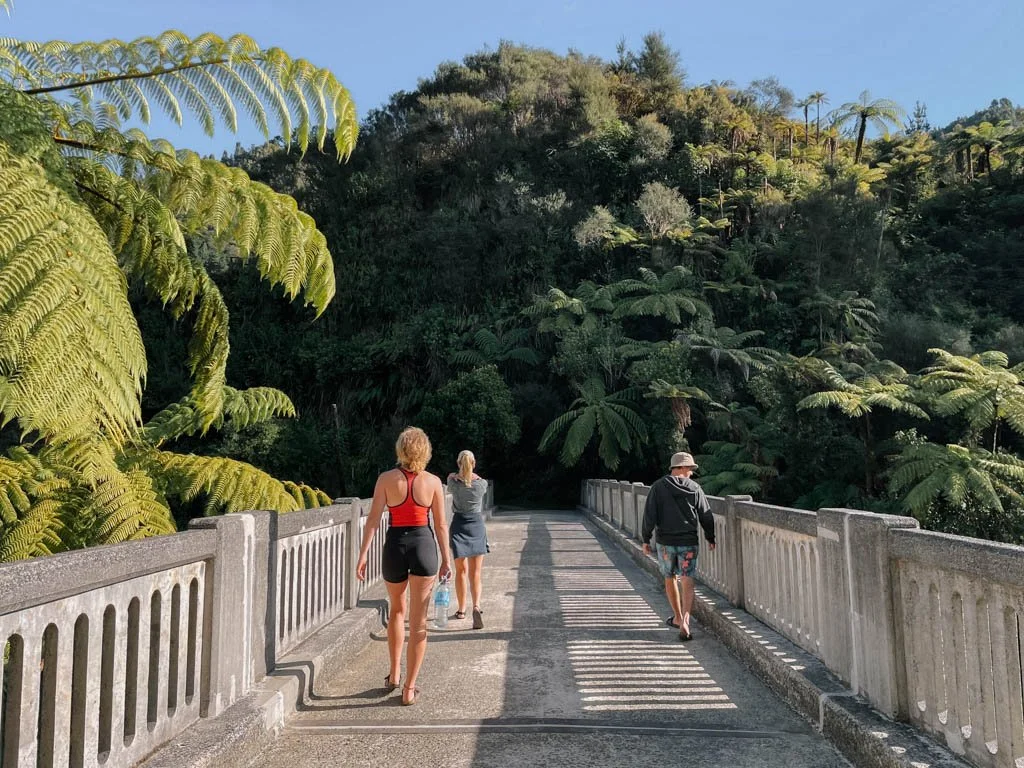
The Whanganui River Journey

The Whanganui Journey isn’t a walk — it’s a 3-5 day canoe trip down the Whanganui River.
The highlights of this journey are paddling through the tall, vegetation covered walls of gorges, with the Whanganui river a coffee coloured swirl beneath you.

It feels eerily prehistoric at times, with birds swooping out of the canopy and wild goats appearing out of the foliage.
This Great ‘Walk’ had its challenging moments — I was lucky to not capsize, but paddling into strong head winds for seven hours wasn’t so fun. But it’s a unique experience in a wild part of the North Island.
You can choose from three days or five days of paddling. My group opted for three days, which for us was enough. The extra couple of days don’t add a lot to the journey, unless you’re a very keen kayaker.
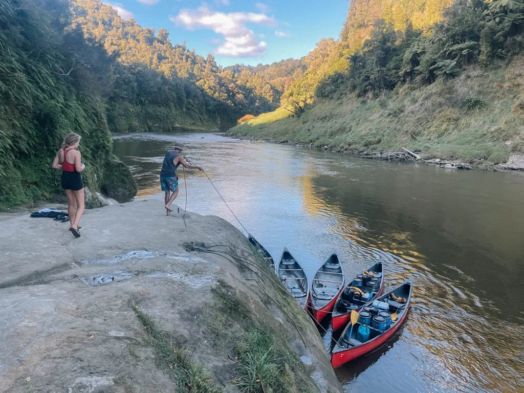
A lot of the paddle is through farmland, which was less interesting from a scenic perspective. The campsites weren’t overly pretty, and the river was too rough for swimming, so novelty value aside, I didn’t feel like this was an expedition of any particular note.
A guide to Aoraki/Mount Cook National Park